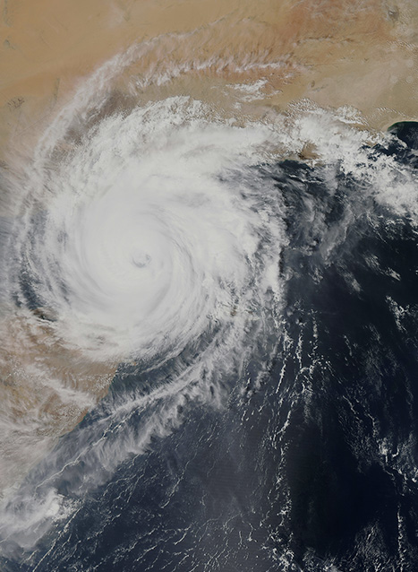
Tropical Storm Lidia and the Environmental Risks
31 Aug 2017
Tropical Storm Lidia is set to make landfall on the peninsula of Baja California, Mexico near the resort city of Los Cabos on the evening on the 31 August, this is a popular tourist destination and receives over two million visitors a year. A tropical storm is a category of storm which produces winds between 62-117 km/h (39-73 mph), but there is expected to be some strengthening over the next 48-hours potentially giving storm Lidia hurricane strength winds.
Key Points
- Tropical Storm Lidia is expected to make landfall 31 August.
- The storm is moving at about 11km/h north-northwest.
- Substantial rain is predicted across the Baja California peninsula and west coast of Mexico.
Situational Summary
Environmental – Tropical Storm Lidia is set to make landfall on the peninsular of Baja California, Mexico near the resort city of Los Cabos on the evening on the 31 August, this is a popular tourist destination and receives over two million visitors a year. A tropical storm is a category of storm which produces winds between 62-117 km/h (39-73 mph), but there is expected to be some strengthening over the next 48-hours potentially giving storm Lidia hurricane strength winds. The tropical storm force winds are being felt around 250km (160 miles) from the eye of storm. There is now a tropical storm warning for North of Puerto San Andresito to Punta Abreojos, north of Loreto to Bahia San Juan Bautista, and north of Guaymas to Bahia Kino.
Heavy rains are predicted on the Baja California peninsula, 20-30cm (8-12 inches) of rainfall is expected across Baja California Sur and western Jalisco state. The heavy rains carry an increased risk of landslides mudslides and flooding. The high winds place the coast of the peninsula and coastal areas of mainland Mexico between Huatabampo and Las Arenites at risk of storm surges and flash flooding.
The storm is predicted to head north-northwest up the main body of the Baja California peninsula for the next few days and then sometime on 1 September to turn west and head back out to the Pacific Ocean.
SECURITY ADVICE
EnvironmentModerateTravellers are advised to pay close attention to weather updates for any changes that may affect their location. For the duration of the storm, it is vital to leave low-lying areas and protect windows with storm shutters. At present, it is advisable to stay in your current location for the duration of the storm and to ensure it is secure and well stocked with food and water, medications, a fully charged cell phone, and a generator if possible. Food supplies should consist of non-perishable items and be enough to support each family member for at least three days. One gallon of water per day per person is also recommended. It is also advisable that families and loved ones are aware of your current position and kept regularly updated so that they can send assistance in case the worst happens. Travellers who are on holiday, should follow the instructions of the hotel authorties as they will have their own tropical storm plans and formailities. Travellers may wish to use travel-tracking technology with an intelligence feed to stay updated of storm and security-related events.
Travellers utilising air travel on the east coast of Mexico in the next few days should contact their airline to see if and how their flights are effected by tropical storm Lidia. For more, and to follow the path of the storm, see the United States’ National Hurricane Centre website at http://www.nhc.noaa.gov/.